


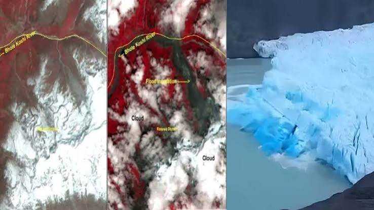
New Delhi, August 27, 2026 : Satellite imagery released by the Indian Space Research Organisation (ISRO) has revealed significant surface changes in a glacier region near the Trishuli River, close to the Nepal-Tibet border, following the devastating floods that struck Nepal on August 25, 2026.

A preliminary assessment by ISRO’s National Remote Sensing Centre (NRSC) has mapped extensive changes in the high-altitude terrain, providing fresh insights into the possible chain of events behind the deadly flash floods.
Glacier Region Shows Major Surface Disturbance
The “before-and-after” satellite imagery indicates substantial disturbance across the glacier and surrounding terrain. The analysis focused on areas near the Trishuli and Bhote Koshi river systems, where floodwaters and debris caused widespread destruction downstream.
ISRO’s preliminary assessment suggests that the disaster may have begun with an ice-rock avalanche or landslide, which temporarily obstructed a river channel.
The subsequent sudden release of the impounded water, mixed with large quantities of debris, is believed to have generated powerful flash floods and a heavy debris surge along the Trishuli River system.
Resourcesat-2A Captures High-Altitude Changes
The avalanche-related changes were captured by Resourcesat-2A, an Indian Earth-observation and remote-sensing satellite.
The satellite images reveal:
- Extensive surface disturbance near the glacier
- Major changes in the high-altitude terrain
- A swollen Bhote Koshi River
- Large-scale downstream flooding
- Extensive movement of water and debris through the river system
The imagery is helping authorities and experts assess the scale of the geological and hydrological changes following the disaster.
NRSC Supporting Disaster Assessment
ISRO’s National Remote Sensing Centre plays a key role in acquiring and processing satellite-based remote-sensing data. It also supports aerial remote sensing, data dissemination and disaster-management decision-making.
Satellite observations are particularly valuable in remote mountainous regions where access on the ground can be extremely difficult following landslides, avalanches and floods.
Trishuli River System Hit by Flood Surge
The Trishuli River, originating in Tibet, is one of the major tributaries of Nepal’s Narayani River system. It flows through central Nepal and is also known internationally for its white-water rafting routes.
Rivers originating in Nepal eventually drain toward the Indo-Gangetic plains, making major flood events in the Himalayan region significant not only for Nepal but also for downstream areas.
Northern Nepal Among Worst-Hit Areas
Nepal was struck by a sudden and destructive flood surge on August 25, leaving multiple people dead and many others missing.
The northern regions suffered particularly severe impacts, with Rasuwa district, located along the China-Nepal border, among the worst-affected areas.
The initial flood surge may have passed, but authorities remain on high alert because of the possibility of secondary flooding, landslides and additional debris flows.
Risk of Secondary Flood Surges
Experts have warned that debris and ice avalanches can create temporary natural dams in mountain river systems. If such blockages suddenly fail, large volumes of trapped water and debris can be released downstream, producing potentially dangerous secondary flood waves.
The latest ISRO satellite observations could therefore prove important in identifying disturbed terrain, temporary blockages and vulnerable stretches of the river system.
The findings remain preliminary, and further satellite observations and ground-based assessments will be required to establish the complete sequence of events that triggered the devastating floods.